The Watershed Atlas · No. 01 — Lower Eighteenmile · the atlas · No. 06 — California Branch
The Watershed Atlas · No. 06
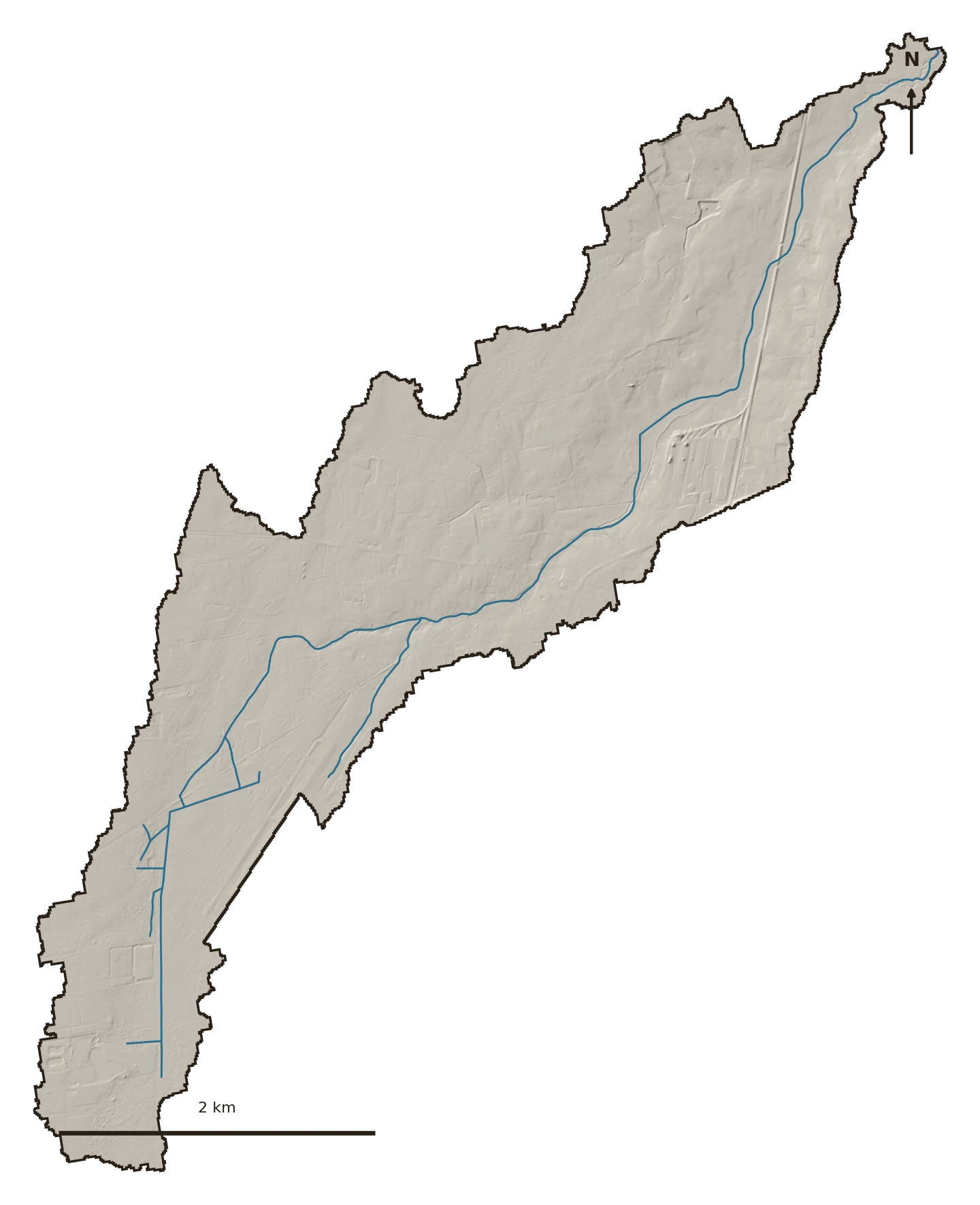
The outlier — a low, flat, wet Coastal-Plain stream near Moncks Corner, part of a stream-buyout and restoration effort. It’s in the atlas on purpose: it reads nothing like the Piedmont creeks, and the contrast is the lesson. Not every watershed sheds water the same way.

The ground
California Branch drains about 4.4 square miles of the Lowcountry Coastal Plain — flat, sandy-to-clayey, and wet. Where the Piedmont creeks sit on well-drained group-B clay, this watershed is 86% hydrologic group C and D: soils that hold water near the surface, with wetlands and ponded floodplain doing much of the storage.
That single fact changes how you read everything else.
What's changing
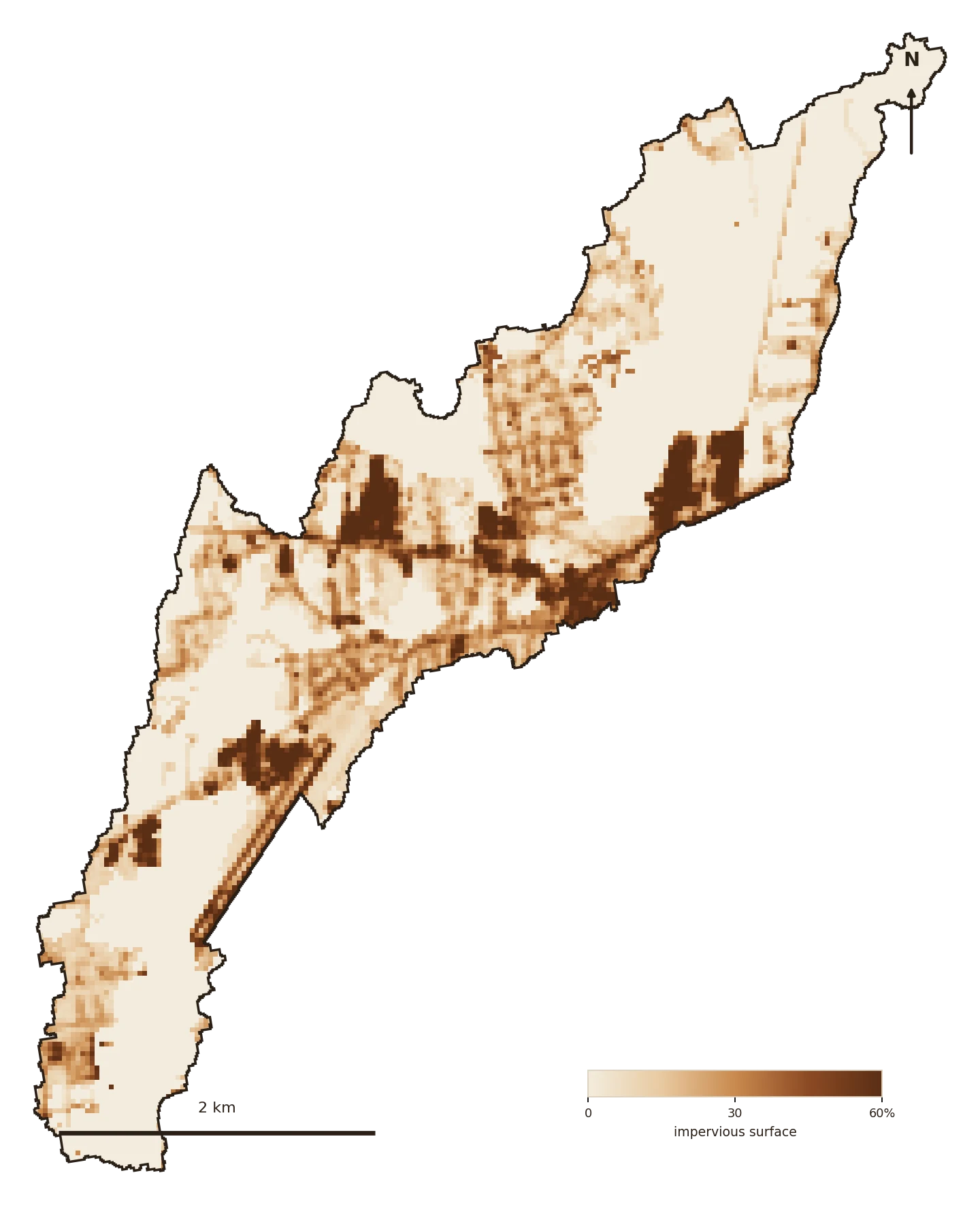
Impervious cover rose from about 11% to 13% — just over the 10% degradation threshold. But on Coastal-Plain soils that already run off readily, hardening does less additional work than it would in the Piedmont: the ground was never a great sponge to begin with.


Where the green is
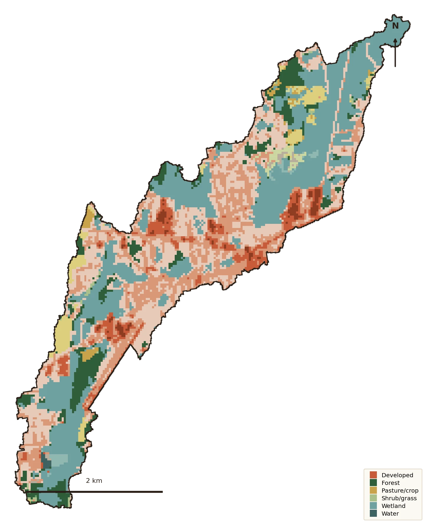
Developed land went from about 44% to 50% of the watershed since 1985; forest fell from 14% to 9%. The composition is more mixed than the Piedmont creeks, with the wetland and low-ground share that comes with Coastal-Plain terrain.
Water quality — the 303(d) list
California Branch is small enough that it isn't a separately monitored segment on the state's 303(d) list.
But it drains straight into the low Coastal-Plain waters of the Cooper River / Lake Moultrie system — which is listed, for the sediment and low-oxygen pressures typical of altered Coastal-Plain streams. Whatever this watershed sheds, it sheds into an already-impaired water.
Source: EPA ATTAINS (the national clearinghouse for state Clean Water Act §303(d)/305(b) assessments), current reporting cycle. “Cause” = the pollutant; “use” = what it keeps the water from supporting (swimming, aquatic life).
What the water does now
Here the runoff numbers come with an asterisk. On these poorly-drained soils the natural curve number is already high (~78), so the model shows a modest hardening effect — but the standard TR-55 method assumes soils and slopes the Coastal Plain doesn’t have. Read the direction, not the decimals:
California Branch runs off readily because it’s flat and wet, not mainly because it’s hardening. That’s the contrast worth holding onto: the same 13% impervious means something very different here than it would on a Piedmont hillside. Stewardship on the Coastal Plain is about wetlands and floodplain connection, not curve numbers.
Why it’s in the atlas
Put next to the Piedmont creeks, California Branch makes the pattern legible: hardening matters most where the ground used to soak water up. On the Coastal Plain, where it never did as well, the levers are different — protect the wetlands and the floodplain that do the storing, rather than chase a curve number.
Knowing which watershed you’re in is the first act of stewardship. This one proves why.
Slow it · spread it · sink it
The receipts
Delineated fresh from its Coastal-Plain outlet via USGS SS-Delineate (4.44 sq mi). Every figure computed locally from public sources; the runoff model carries a Coastal-Plain caveat.