The Watershed Atlas · No. 01 — Lower Eighteenmile · the atlas · No. 04 — Golden Creek
The Watershed Atlas · No. 04
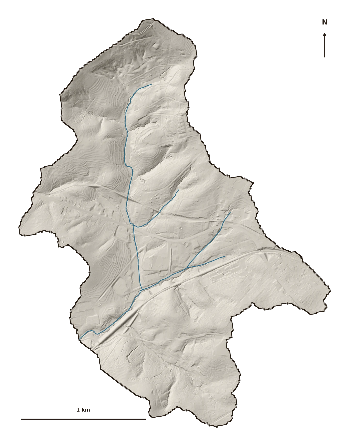
A small creek near Easley — one of the three (with Twelvemile and Eighteenmile) that a big group wrote a watershed plan around years ago. It’s the least built-up watershed in this atlas, which makes it the most hopeful: still mostly catching its own rain, and right at the moment where stewardship is cheapest.

The ground
Golden Creek drains a square-and-a-half of Pickens County near Easley: old fields, woods, and spreading residential edges. It sits on the same weathered Piedmont clay as its neighbors — 87% hydrologic group B — but it’s held onto more of its cover than any other watershed here.
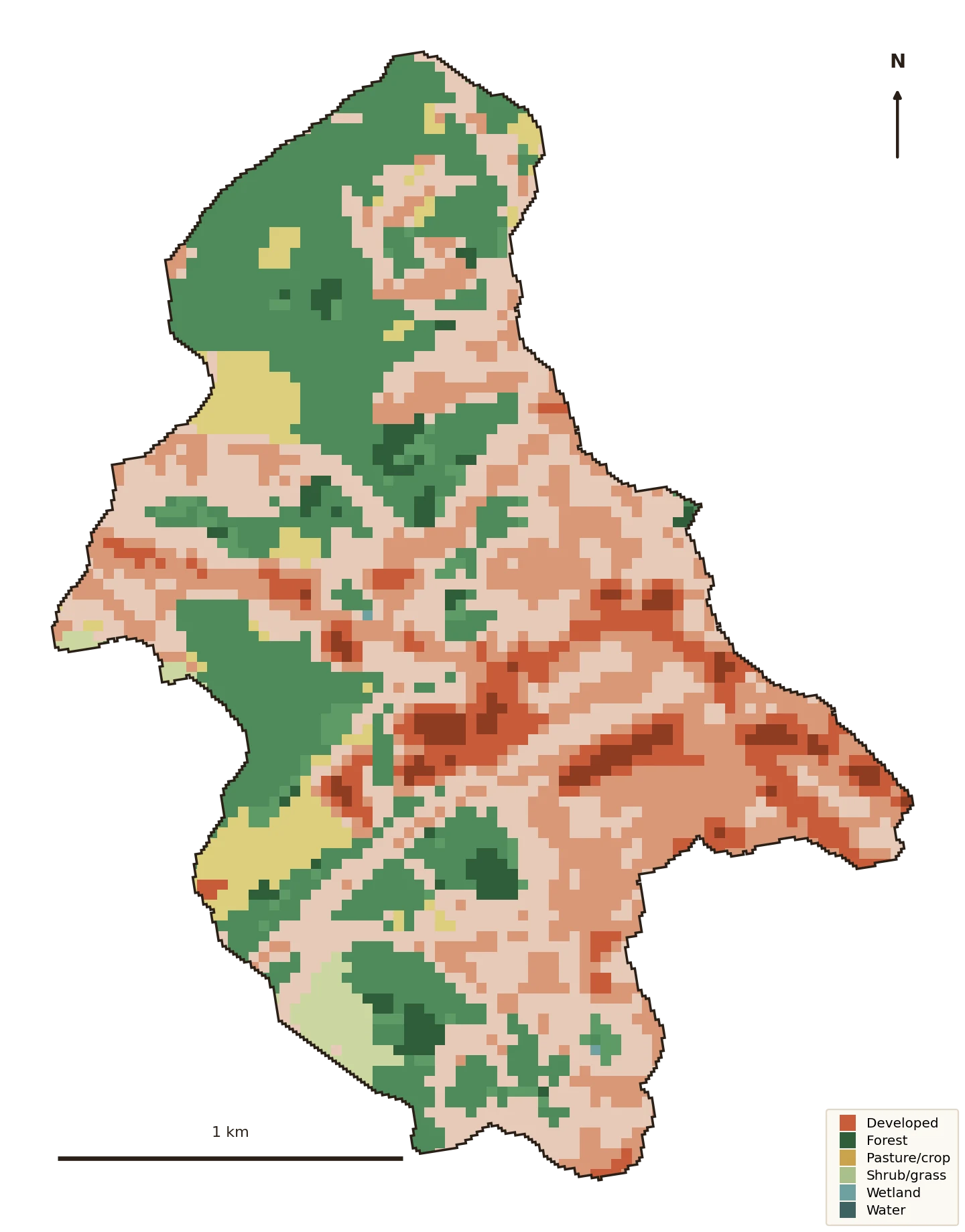
In 2023 forest still covered about a third of it. That’s the good news. The trend line is the warning.
What's changing
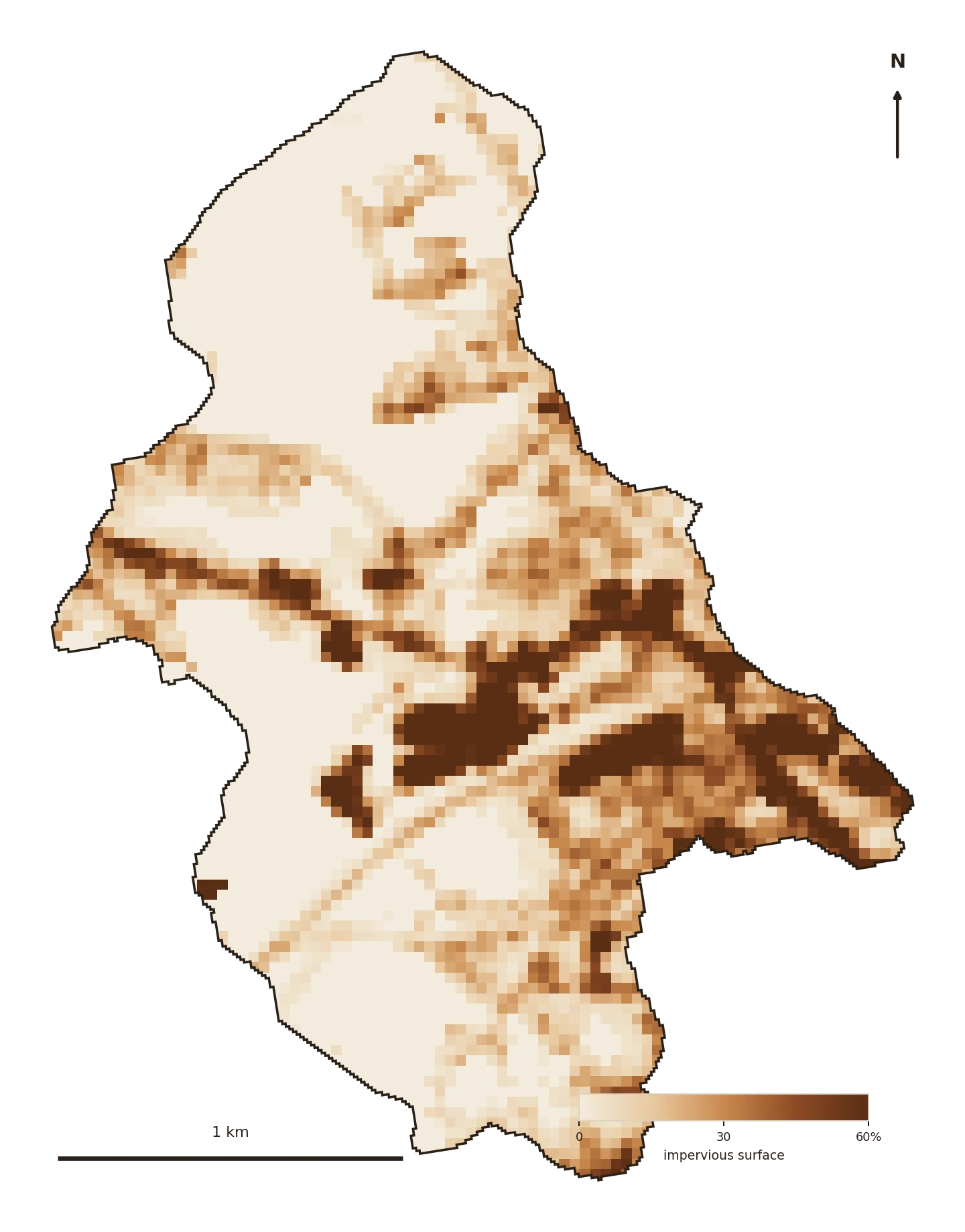
Impervious cover rose from about 12% of the watershed in 1985 to 16% in 2023 — recently across the Center for Watershed Protection’s first threshold, where streams begin to degrade past 10% hardening. Golden isn’t in trouble yet. It’s at the tipping point, which is exactly where a plan is worth the most.


Where the green is
Developed land went from about 50% of the watershed in 1985 to 61% in 2023; forest fell from 41% to 32%, and old farm ground from 8% to 5%. Set against the built-out watersheds in this atlas, Golden is what the others looked like a generation ago.
Water quality — the 303(d) list
Golden Creek is small enough that it isn't a separately monitored segment on the state's 303(d) list.
But it drains straight into the Twelvemile–Golden Creek plan area (Lake Hartwell system) — which is listed, for the turbidity and nutrient pressures documented across that multi-creek watershed plan. Whatever this watershed sheds, it sheds into an already-impaired water.
Source: EPA ATTAINS (the national clearinghouse for state Clean Water Act §303(d)/305(b) assessments), current reporting cycle. “Cause” = the pollutant; “use” = what it keeps the water from supporting (swimming, aquatic life).
What the water does now
The curve-number model shows the shift. Golden’s runoff curve number rose from about 68 to 69 as it hardened — modest, because there’s still green to soak up rain:
Golden still absorbs most of what falls on it. Every acre kept in cover here holds that number down. This is the watershed where “slow it, spread it, sink it” costs the least, because most of the sinking is still happening on its own.
Why it matters now
By the time a watershed reads like the Reedy or Hunnicutt, fixing it means undoing pavement. Golden isn’t there. Protecting the forest it still has, and guiding how the new lots grade and drain, keeps it out of the impaired column entirely — for a fraction of the cost of a cleanup.
That’s the whole case for meeting a watershed at the tipping point instead of the bottom.
Slow it · spread it · sink it
The receipts
Delineated from the USGS gage near Easley (02186090, 1.53 sq mi — matching the published drainage area); every figure computed locally from public sources.