The Watershed Atlas · No. 01 — Lower Eighteenmile · No. 02 — Hunnicutt · No. 03 — Berkeley
The Watershed Atlas · No. 03
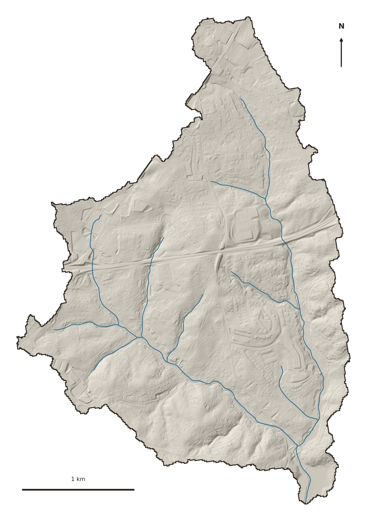
A small headwater tributary of Eighteenmile Creek on Clemson’s east side — the “Berkeley Orchard” reach, where a capstone crew hand-taped ten cross-sections in the channel. Barely two miles of stream, and one of the fastest-developing little watersheds in the area.

The ground
Berkeley Creek drains 2.8 square miles of the Eighteenmile basin — old orchard, new subdivisions, and the ground filling in between. Like the rest of the Piedmont here, it is almost entirely group-B clay: 94% of the watershed drinks water at the same rate.
What sets it apart is the pace. This is a headwater — the top of the system — and it is building out faster than almost anywhere upstream of it.
What's changing
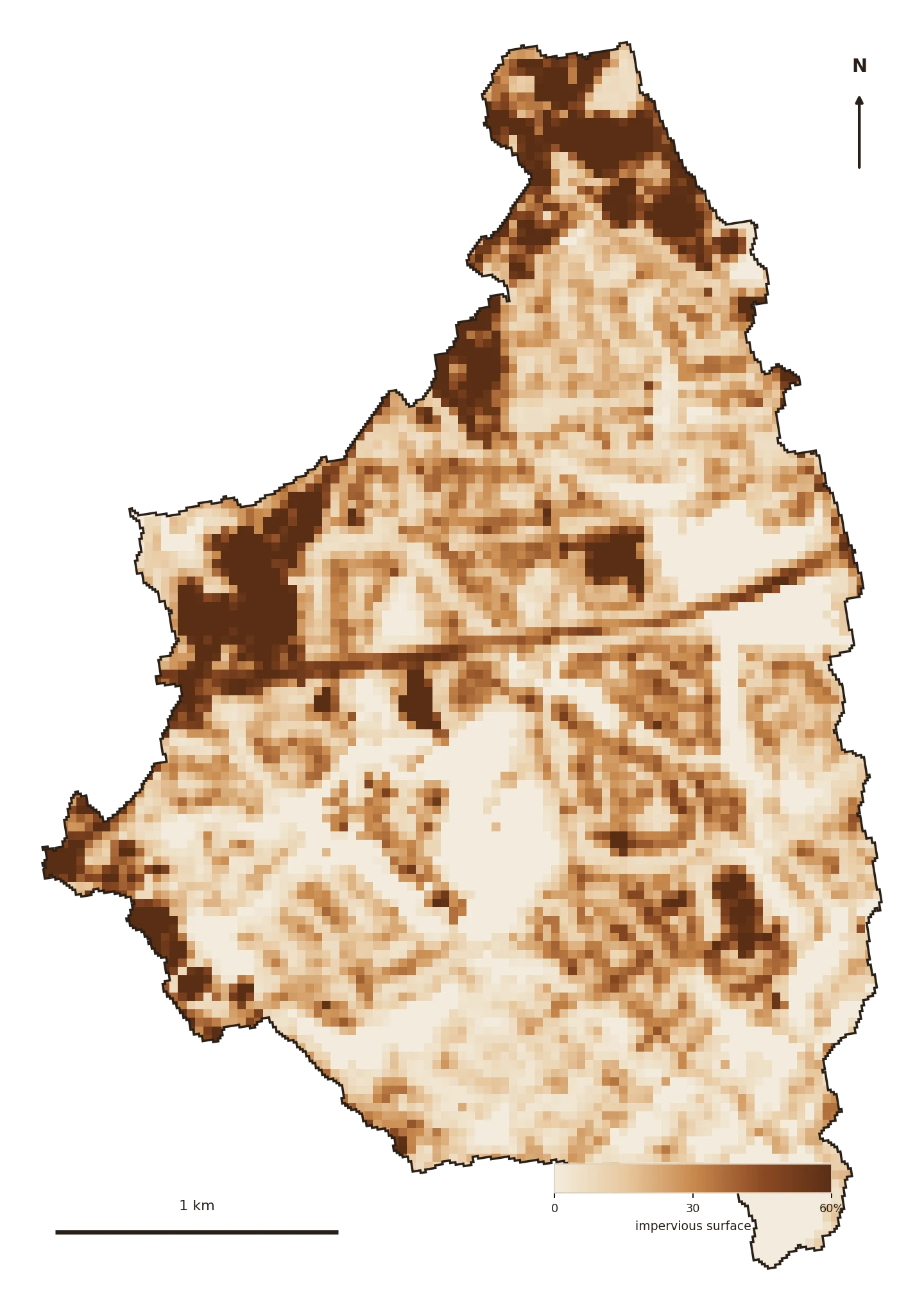
Impervious cover climbed from about 14% of the watershed in 1985 to 21% in 2023. That matters because of where the thresholds sit: the Center for Watershed Protection’s model marks stream degradation beginning past 10% hardening and healthy aquatic life generally lost past 25%. Berkeley crossed the first line decades ago and is climbing steadily toward the second.
Water here is still spread thin across the top of the watershed, before it concentrates into the channel. Slowing it now — in the orchard, the new lots, the roadside swales — costs a fraction of fixing the flood downstream. The stream-scale view of this reach, with the ten field-taped cross-sections, lives in Four Streams.


Where the green is
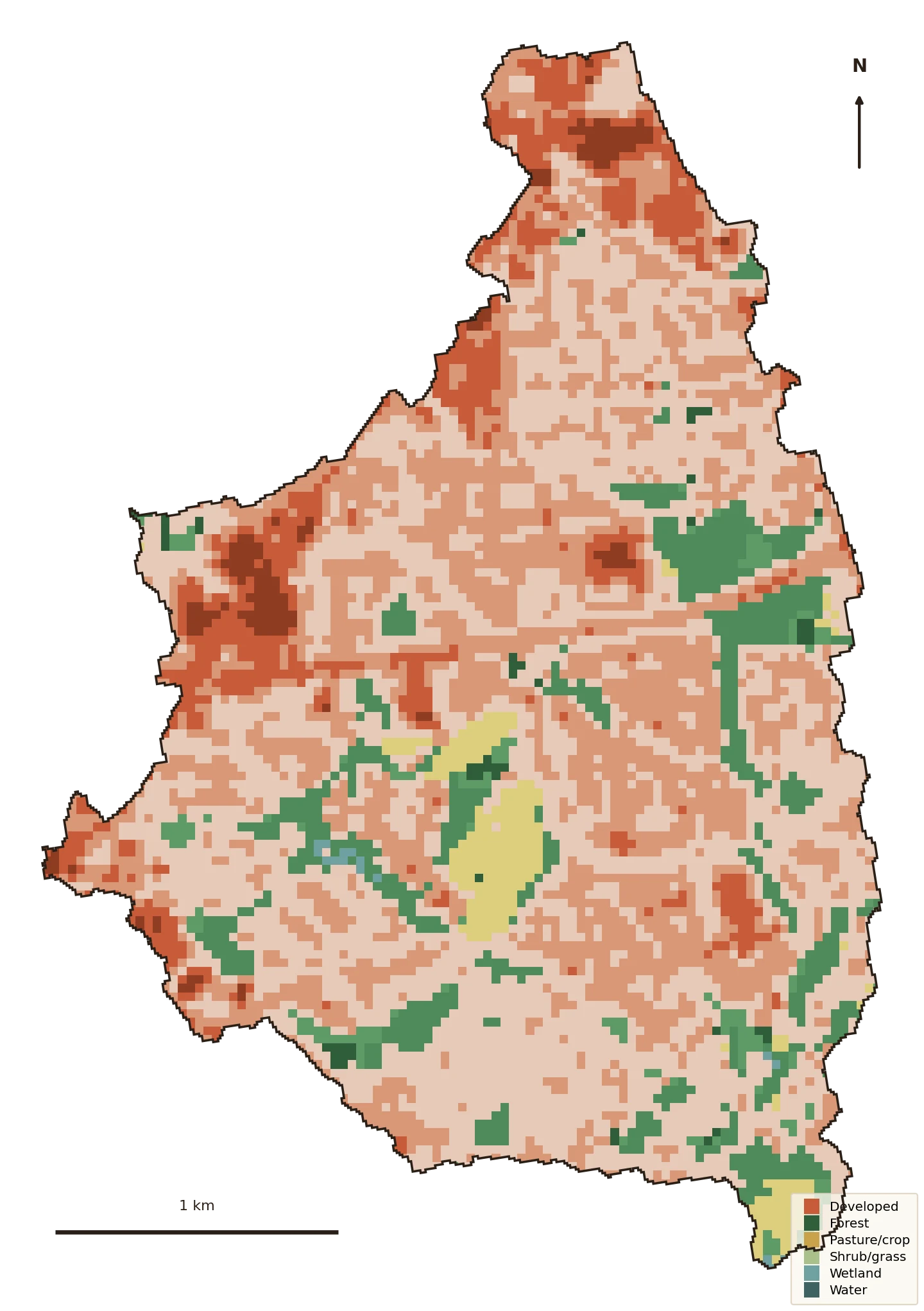
Developed land went from about 69% of the watershed in 1985 to 85% in 2023. Forest fell from 21% to 12%, and the old orchard/pasture from 10% to 3%. Set against its own parent watershed — Lower Eighteenmile, No. 01 — Berkeley is the harder-edged, faster-changing headwater.
Water quality — the 303(d) list
Berkeley Creek is small enough that it isn't a separately monitored segment on the state's 303(d) list.
But it drains straight into Lower Eighteenmile Creek — which is listed, for turbidity, nutrients, and pathogens (bacteria) (with a cleanup plan on record). Whatever this watershed sheds, it sheds into an already-impaired water.
Source: EPA ATTAINS (the national clearinghouse for state Clean Water Act §303(d)/305(b) assessments), current reporting cycle. “Cause” = the pollutant; “use” = what it keeps the water from supporting (swimming, aquatic life).
What the water does now
The curve-number model puts the flashiness in numbers. Berkeley’s runoff curve number rose from about 67 to 69 as it hardened — and being small and steep, it responds fast:
A 14% jump — about 7 million extra gallons from one ordinary rain, arriving faster and heading straight for Eighteenmile Creek. The 100-year storm sheds roughly 48 acre-feet more.
Why it matters downstream
Berkeley itself is too small to be its own line on the state’s impaired-waters list — but it is a headwater of a creek that is listed. Turbidity, nutrients, and bacteria don’t originate in the mainstem; they wash off the hardening headwaters and collect downstream. Fixing the big creek means fixing the little ones that feed it.
That is the good news, too: the leverage is highest right here, at the top, where the water is still easy to catch.
Slow it · spread it · sink it
The receipts
The watershed was delineated fresh from its Eighteenmile confluence using USGS SS-Delineate (2.81 sq mi, matching the atlas’s outlet drainage area); every figure is computed locally from public sources.